
|
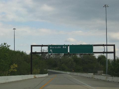
This 2010 photo shows the ramp from northbound I-95 at EXIT 60 (Moravia Road) in Baltimore. A stub ramp--blocked off by Jersey barriers on the right--was to extend to the northbound Windlass Freeway (MD 149), and for much of the 1970s and 1980s, the sign on the right read "FUTURE EXIT ONLY" in anticipation of the freeway. (Photo by Steve Anderson.) |
||
|
DESIGNED TO RELIEVE CONGESTION ON I-95: As proposed in the 1964 Baltimore Metropolitan Area Transportation Study (BMATS), which incorporated the city's aggressive "10-D" expressway construction program, the seven-mile-long Windlass Freeway was to parallel I-95 from the then-proposed Moravia Road interchange (now EXIT 60 on I-95) at the Baltimore city line northeast to MD 43 (White Marsh Boulevard) in Middle River, Baltimore County. The Windlass Freeway was to revive the old MD 149 designation that had been removed from nearby Ebenezer Road--a local road through the area--in 1960. |
||
|
One 1964 map suggested the Windlass Freeway was to be extended further northeast--toward an extension of Bird River Road--as part of a redevelopment of the Middle River area. Another map from that era proposed a conceptual extension to the west--called the "Cold Spring Freeway"--that was to form the northern arc of an "Inner Loop" that would have connected I-95 with I-83 and I-70. This extension would have been routed along Moravia Road, Cold Spring Lane, and Hilton Street. |
||
|
|
||
|
By the mid-1970s, the State Highway Administration (SHA), the successor to the SRC, focused its attention on completing the Interstate highway network in Baltimore City, leaving lower-priority route like the Windlass Freeway devoid of funding. In 1977, the RPC drafted that eliminated many of the freeways recommended in the 1964 BMATS plan and the 1967 "Suggested Development Plan," shifting the focus of development in favor of the Baltimore Metro and other mass transit. With the formal adoption of the plan in 1978, the Windlass Freeway was canceled. |
||
|
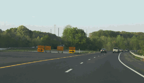
Just before EXIT 36 (MD 702 / Southeast Boulevard) on the northbound Baltimore Beltway (I-695) in Rosedale--as shown in this 2004 photo--a stub section of roadway hints at the unbuilt northerly extension of the Windlass Freeway (MD 149). (Photo by Alex Nitzman, www.aaroads.com.) |
||

|
SOURCES: Multi-Purpose Centers for the Baltimore Region: Traffic Analysis, Alan M. Vorhees and Associates, Inc. (1964); "Road Unit's Plan Decried," The Baltimore Sun (3/14/1966); "Road, Tunnel Choices Tied," The Baltimore Sun (9/13/1967); "Contracts Given for Nine Projects," The Baltimore Sun (2/01/1970); "Maryland 20-Year Highway Program (1977-1996)," Maryland State Highway Administration (1972); "Major Transportation Milestones in the Baltimore Region Since 1940," Baltimore Metropolitan Council (2006); Alex Nitzman; Mike Pruett. |
||
|
WINDLASS FREEWAY LINKS: |
||

|
Back to The Roads of Metro Washington-Baltimore home page. |
||
|
Site contents © by Eastern Roads. This is not an official site run by a government agency. Recommendations provided on this site are strictly those of the author and contributors, not of any government or corporate entity. |
||